Final Assignment: A Subjective Atlas

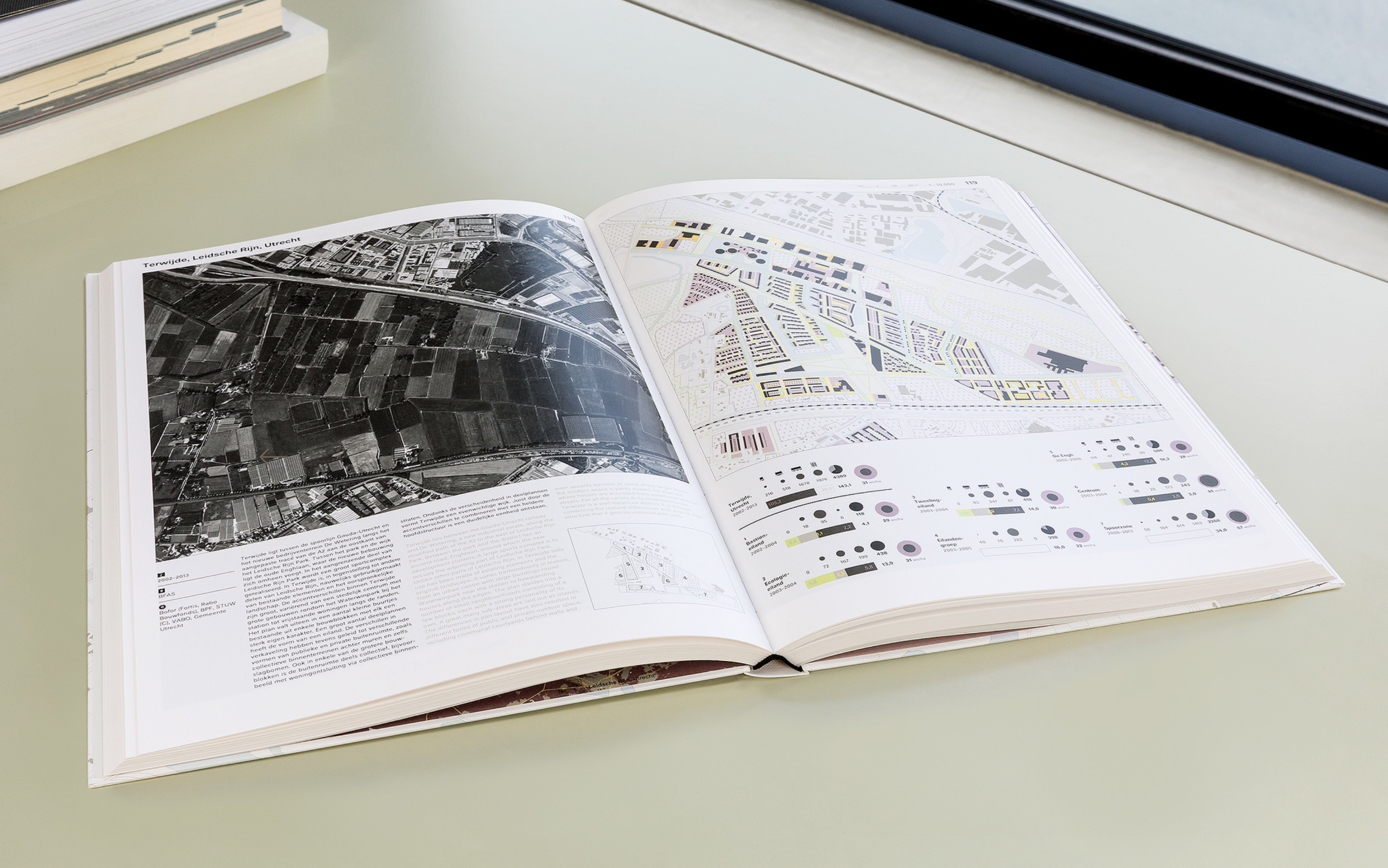
Jelte Boeijenga, Jeroen Mensink. Vinex Atlas. Cartography & book design by: Studio Joost Grootens. 2008. See also this video of the work.
Design an atlas composed of your responses to each assignment from this module sequence.
In the process of making your atlas revisit each assignment and revise your initial work. Some questions to consider when revising:
- what precedents is the project drawing on?
- what are some similar or relevant precedent projects that I can draw from for inspiration/guidance?
- what is the core argument or narrative?
- how might I make the subject/perspective/argument of this map more clear?
- how might I make the graphic approach more coherent? more related to the subject of the map?
- what is the basemap? does it help to orient the reader? does it help to make the argument of the map more clear? if not, can it be re-designed to accomplish those goals?
- what design approaches are used for the map elements?
- how is color being used? does it help to convey the narrative of the map?
- how are symbols being used? does each symbol convey a unique type of information?
- what role does each element of the map play in conveying the argument/narrative of the map? are there any unnecessary elements?
Assemble your final maps into a single designed PDF booklet (with a designed cover page).
Please include a thoughtful but (very) concise (1-2 sentence) description of each map.

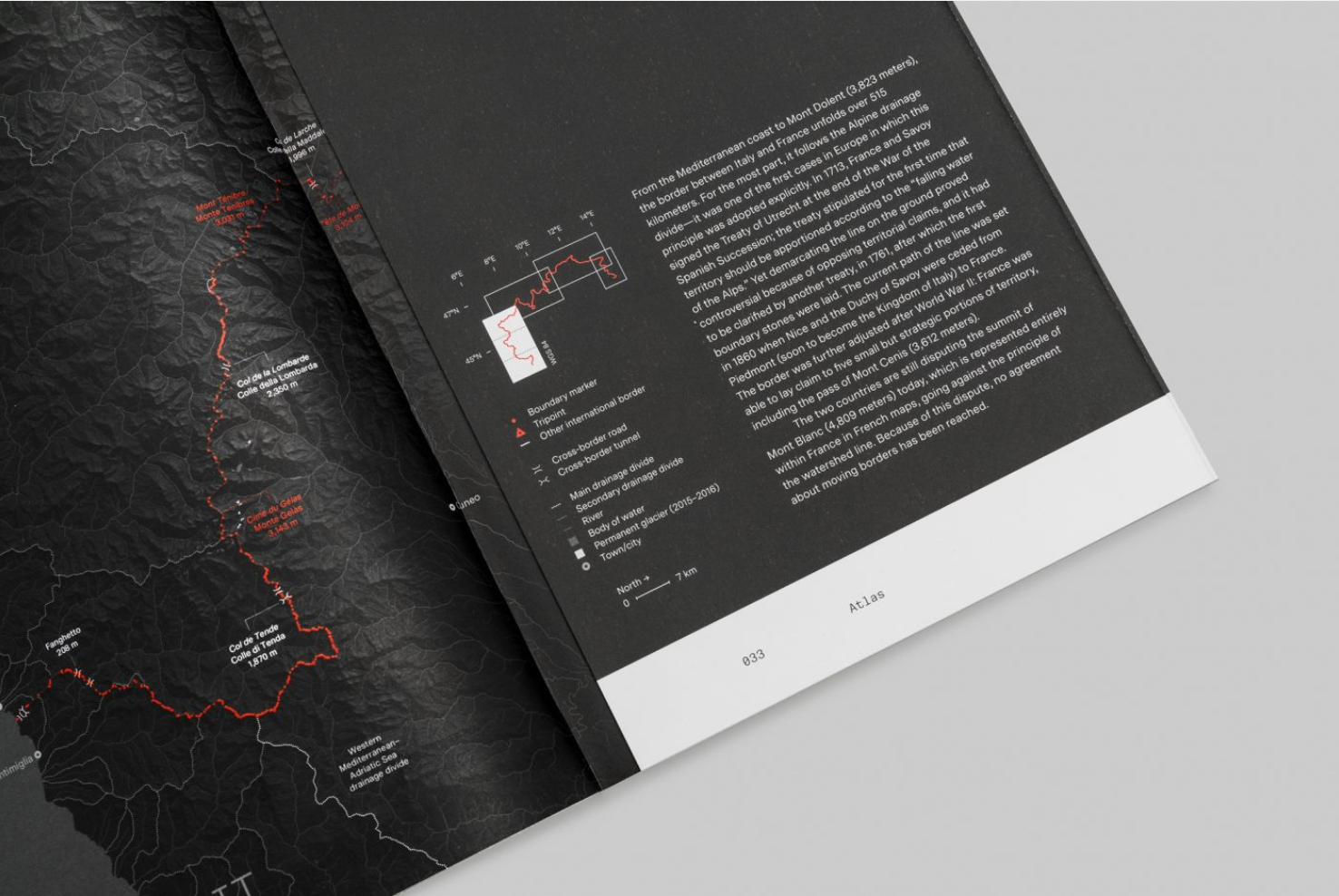
Studio Folder and Andrea Bagnato. A Moving Border: Alpine Cartographies of Climate Change, 2019
Precedents
When working on your atlas make sure to seek out many different precedent projects to help inform your work and graphic approach. Some places to start:
General Critical GIS/Radical Cartography resources
-
Exhibitions from the Norman B. Leventhal Map & Education Center
-
- Companion documentary: This is not an Atlas: A Documentary on Counter-Cartographies
-
Adam Loften & Emmanuel Vaughan-Lee, "Counter Mapping" Emergence Magazine on Maps of the Zuni world.
Making Data from Archives
-
Marshall, Bob, Brian Jacbos and Al Shaw. "Losing Ground," ProPublica and The Lens. August 28, 2014
-
David Rumsey Map Collection. Large collection of scanned archival maps.
-
Price Fishback et al. "New Evidence on Redlining by Federal Housing Programs in the 1930s". September 2021. Working paper. New research complicating the narrative on HOLC (aka "redlining") maps.. Uses data from University of Richmond.
Making Data From Observation & Sensing
-
Kim, Annette. “Mapping the Unmapped: Mixed Use Sidewalk Spaces,” Sidewalk City: Remapping Public Space in Ho Chi Min City. University of Chicago Press, 2015 pp. 100-169. Book available to view online via CLIO
- See also online: https://slab.today/maps-2019/.
-
Troittin, Masson, Tallon. Usages: A subjective and Factual Analysis of Uses of Public Space. 2011
-
Svarre, Birgitte and Jan Gehl. How to Study Public Life. 2013. ebook via Columbia Library
Making Data from Satellites
-
Benson, Michael, "Watching the Earth Burn" The New York Times. December 28, 2020
-
Wallace, Tim, Derek Watkins, and John Schwartz. “A Map of Every Building in America.” 2018
- Brief technical documentation: Microsoft/USBuildingFootprints. 2018. Microsoft, 2020.
-
Badger, Emily and Quoctrung Bui, "A Decade of Urban Transformation, Seen From Above" Dec. 27, 2019
-
Begley, Josh, “Officer Involved.” The Intercept. December 30 2017.
-
Begley, Josh, “Best of Luck with the Wall.” Field of Vision. 2016
-
Cooper, Danika, “Invisible Desert.” E-Flux Architecture. February 5, 2020
-
Paglen, Trevor. Blank spots on the map: the dark geography of the Pentagon's secret world. London: Penguin, 2009. [Preview available online here]
-
Folder. "Uncharted – Footnotes to the Atlas." Oslo Architecture Triennale 2016
Maps & Narrative
-
Wood, Dennis. "Everything Sings: Maps for a Narrative Atlas." In Places Journal. 2011.(Columbia Library holding)
-
Solnit, Rebecca and Joshua Jelly-Schapiro, Nonstop Metropolis: A New York City Atlas. California: University of California Press, 2016.
-
Mogel, Lize, and Alexis Bhagat, eds. An Atlas of Radical Cartography. Los Angeles: Journal of Aesthetics & Protest Press, 2008. (Columbia Library holding and website with book excerpts here)
-
Forensic Architecture's Investigations. Many projects, lots of different examples on maps and/as investigations/narratives.
New York Times Graphics Department map-forward stories
-
See 2020: The Year in Visual Stories and Graphics for a compiled list of visual stories from 2020. Not all of these are map based, but many are. At the bottom of the page are links to similar compilations going back to 2012.
-
Wallace, Tim. 2016. “The Two Americas of 2016.” The New York Times, November 16, 2016.

